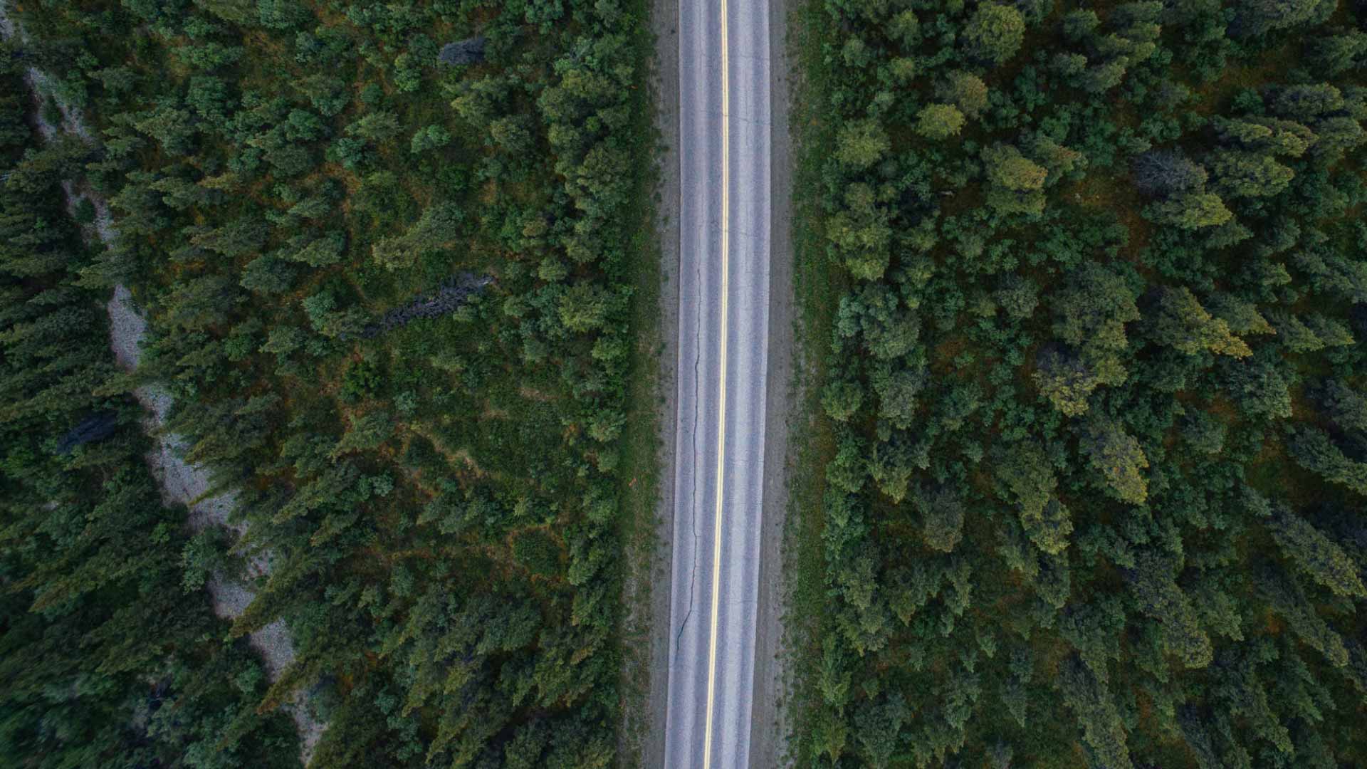
The Alaska Highway, commonly referred to as the “Alcan” Highway (Alaska + Canada = Alcan) is a remote highway that stretches from British Columbia through the Yukon before it reaches Alaska. Along the way you’ll experience all sorts of wildlife, breathtaking views, hot springs, and more. While the drive is beautiful, it is a remote area of the world so some preparation will do you well. we’ve driven the AlCAN and took lots of notes along the way to help you on your own trip fully confident.
Like you, before we set off to drive the infamous AlCAN we had so many questions and we even had some nerves mixed in there. What if we ran out of gas? How often will we find grocery stores? Should we be worried about wildlife? If this sounds like you, keep reading.
For more information about prepping for your time in Alaska, checkout our Alaska: The complete guide article.
Location: The Alaska Highway officially starts in Dawson Creek, British Columbia and ends in Delta Junction, Alaska
Length: 1,387 miles (2,232 km) long
Terrain: Mountains, prairies, and more. Trust me, you’ll see it all!
What Country is the Alaska Highway in? 1,182 miles (1902 km) are in Canada, and 240 miles (386 km) in the USA. unless you continue on the unofficial section of the AlCAN all the way up to Fairbanks which adds an additional 98 miles (157 km) past Delta Junction.
How many people drive the Alcan every year? More than 300,000 people drive the Alaska Highway every year between May to September according to The Guardian.

There are lots of highway variations you can take to reach the start of the Alcan Highway. we’d recommend going one of two scenic drives: the Sea-to-Sky Highway through British Columbia, or up the Icefield Parkway through Jasper and Banff National Parks in Alberta.
While neither of those stretches of road will bring you straight to Dawson Creek, by incorporating them into your route you’ll be incorporating some of the most beautiful stretches of North American road into your road trip. If you have the freedom in your schedule to drive both routes, we’d recommend driving one way up and the other on your way back home.
The Sea-to-Sky Highway begins just north of Vancouver, BC and runs north until it crosses Highway 97. This 254 mile (409 km) section of Highway 99 winds through mountains, valleys, along calm lakes and rushing rivers.
The Icefield Parkway begins in Banff National Park and runs north through Jasper National Park. This 144 mile (232 km) road winds along the continental divide and through some of the most breathtaking mountains in the world.
What we did: We began our trip in Vancouver, BC and drove the Sea-to-Sky Highway on the way north, then drove the Icefield Parkway on the way back south. From there we spent some time in Calgary and Montana after our time in Alaska, thus making the Icefield Parkway the perfect segway into our next leg of adventures. The choice is yours though! Whatever route you take, be sure to enjoy it!
We talk more about what to pack for Alaska over in our Alaska: What to know before you go blog, but here are a few items that are very specific to driving the Alcan Highway which we would highly recommend bringing with you on the road.
The Milepost – If you are looking for a mile by mile guide to all the main roads throughout Alaska and Canada’s surrounding provinces, definitely get The Milepost. We snagged this guide per a friend’s recommendation and we were so glad we did. This guide tells you everything along the way from picnic tables to gas stations to campgrounds and wildlife concentrated areas along the road. While our blogpost is meant to help by giving you our first hand experience, grabbing The Milepost will take a lot of stress off your shoulders when it comes to stressing about where the next gas station is.
Binoculars – We purchased these binoculars at REI right before we hopped onto the Alcan Highway and I’m so glad we did! You’d hate to drive all the way to Alaska and then only see a grizzly bear as a brown blob in the distance. If you haven’t already, invest in binoculars!
Bug spray – This is a MUST. Trust me, the mosquitos can be terrible, especially during the first half of the summer. You’ll need a good bug spray just about every time you step outside.
Bear Spray – We counted over 50 bears along the Alaska Highway. Trust me, if you’re going to be stopping off on any sort of trail along the way, you’re going to need bear spray and bear spray holster.
Note: You’ll need to declare bear spray at customs when you cross the border both into the USA and into Canada. They won’t mind you having it, but don’t forget to include it when talking to border patrol.
[Optional] Extra gas can - We packed an extra 5 gallon fuel can, but truthfully, we never once needed it. Everyone’s car is different, so do what you think is best. For us and our 2019 Sprinter van, we never needed more gas than our tank could hold until the next station. If you plan on going way off grid while you’re up north and driving long stints away from gas stations, bring at least one of these because it’ll be a while until someone finds you.
First off, the Alaska Highway is open and maintained year around. If you’re curious what day it is guaranteed to be open by, that date doesn’t exist. This highway is a lifeline to people living all along it through British Columbia, Yukon, and Alaska so the roads are safe to drive any time of year. However, if you aren’t used to driving in winter conditions (snow and ice), you might want to wait until spring to begin your journey.
The road conditions are mostly good on the Alaska Highway. In fact, we were pretty impressed by how well maintained it was, especially for being such a long, remote highway. That being said, the earlier in the season you go, the more likely you are to encounter sections of dirt road, larger potholes, etc. It takes a while for road crews to repair sections of the road that were damaged during the winter months (snow and ice are hard on roads), so be patient and prepared for anything.
We set out to drive the Alaska Highway in mid May 2019 so we were towards the front end of Alaska’s peak season. Our only bad section of road was in northern British Columbia and was about 20ish miles of dirt and gravel. While it made the outside of our camper van really dirty, the road itself wasn’t terribly bumpy. It was louder and we drove much slower, but it wasn’t that bad.
Please keep an eye out for road crews working on the Alaska Highway. Drive slowly when passing them and be sure to give them plenty of space!

We saw more wildlife in our few days of driving the Alcan than we did our 5 weeks in Alaska. British Columbia and Yukon are full of bears, moose, buffalo, and more! Bring your binoculars and keep and eye out for wildlife along the roadway.
We can’t say enough how important it is to take your time driving the Alaska Highway so you can enjoy the views and wildlife. Allow yourself the freedom to stop for long lunches at pull offs and wait to see what wildlife is around you. Almost every breakfast, lunch, or dinner stop on the side of the road was accompanied by bears or moose. Sit quietly with binoculars and see what comes near as the wildlife forgets you’re there.
As soon as we started driving the Alcan Highway we began a running tally of how many of each animal we spotted during the drive. It turned into a fun Eye-Spy type game to keep both driver and passenger engaged during the drive. Drive: don’t forget to keep your eyes on the road! ;)
Important Note: Driving at night greatly increases your chances of potentially colliding with wildlife on the road. Try to avoid driving after dark if at all possible, but if you must, drive slowly and carefully. It’s also important to note that animals including bears and deer are most active at twilight and sunset so keep your eyes peeled for wildlife along the roadways during those times of day.
Let’s start at the southernmost point of the Alaska Highway and work our way north.
This is where the Alcan officially starts. This town is fully equipped with multiple gas stations grocery stores including Walmart.
Just an hour north of Dawson Creek and only 46 miles (74 km) into the Alcan is one of the largest towns along the Alaska Highway. Personally we found it easier to run all of our errands here rather than in Dawson Creek since the Safeway grocery store and Walmart were only a couple of blocks apart.
We decided to stay the night in Fort St. John which worked really well as a nice launching point for the drive north. We arrived in town early enough to grab dinner and a beer at Might Peace Brewing, then grabbed coffee and wi-fi at Starbucks in the morning before buying groceries at Safeway and a few RV supplies at the Walmart. We were told if we had time we should checkout Artisan Farmhouse but unfortunately they were closed when we passed through. Note: A great way to be a responsible tourist is to support local businesses like Artisan Farmhouse and Might Peace.
About 4 hours (236 mi / 381 km) north of Fort St. John is Fort Nelson. This town is much smaller than Fort St. John, but will have all the basics you might need: fuel (gas and diesel) as well as an IGA and Save-on-Foods grocery stores.
There aren’t really any major towns between Fort Nelson and White Horse (591 mi / 951 km). This is (in our opinion) the most beautiful stretch of the Alcan Highway, but with the beauty comes the more remote surroundings. There will be plenty of places to grab fuel, specifically in Toad River and Watson Lake, but past a few small, seasonal, local establishments, there won’t be much by way of food.
Some of our favorite attractions are also along this remote stretch of road, so keep reading for what we recommend along this stretch.
Whitehorse is the capital of Yukon Territory and it definitely feels like a huge city after driving some pretty remote roads for several days through British Columbia and Yukon. I have to say we were pretty surprised by Whitehorse! It’s a great little town and a wonderful stopover on the long drive to Alaska.
We spent a couple of days here grabbing some more groceries, diesel, and even met up with some friends for breakfast at Burnt Toast Cafe. After sitting in the car for several days, Whitehorse was the perfect place to stretch our legs along the riverwalk and even let our dog (Kramer) stretch his legs at the local dog park.
Delta Junction is the official end of the Dempster Highway. The drive from Whitehorse to Delta Junction is 494 miles (795 km) and covers a lot of beautiful territory. However, past Whitehorse there’s not much by way of cities. There will be towns that will have options for fuel, but that’s about it. Once you arrive in Delta Junction you will have access to a small IGA grocery store.
If you’re heading on to Fairbanks after Delta Junction, you’ll only have 95 miles (153 kms) to Fairbanks which will have far more options for groceries and other basic necessities: Walmart, REI, Safeway, and more.
As we mentioned above in the cities and towns section on this blogpost, there are plenty of options for fuel along the Alaska Highway. If you are worried about your vehicle running out of fuel along the way, definitely pick up a copy of The Milepost as we mentioned earlier. Rather than us telling you every place we stopped along the route, checkout the guide to see how often you will drive pass fuel.
Stores and fuel stations will change every year, even if it’s just their hours. General rule of thumb: when you see fuel, get fuel. Anytime we were anywhere near half a tank we would just go ahead and fill up and we never came close to running out.
Most people (like us) drive the Alcan Highway in some sort of RV or camper van. Since we were traveling with a full kitchen on wheels with us, we never ate out along the route (with the exception of cinnamon buns at the Tetsa River Lodge . Cooking your own food on the road really does allow you the freedom to stop at whatever beautiful pull off you come across along the way.
If you won’t be traveling in a vehicle that has a kitchen, I’d strongly encourage you to at least pack a cooler with basic sandwich ingredients and lots of snacks because restaurants are few and far between on the Alaska Highway.


Starting at mile 0 of the Alcan Highway, don’t forget the classic picture in front of the iconic Alaska Highway sign!
Address: Highway 2, 800 Highway 2, Dawson Creek, BC V1G 3V8, Canada // Google Maps link
Located just 70 miles past Fort Nelson, BC heading north toward Alaska is Tetsa River Lodge which is home to these world famous cinnamon buns. If you’re like us, you’ll be passing Tetsa River Lodge in the morning making these the perfect breakfast treat.
Note: You can also book a cabin or a camping spot at the lodge for a fee (showers are available for a smaller fee if that’s all you’re looking for). We didn’t stay there but it looks to be a nice, safe stop and BONUS: you could literally wake up to warm cinnamon buns! Does it get much better than that?
Address: GPS Coordinates: 59 39’9″N 124 14’7″ // Google Maps link
Just past the cinnamon buns you’ll come across Stone Mountain Provincial Park and Summit Lake. While this lake is relatively small, it’s setting is beautiful! The provincial park (Stone Mountain) is gorgeous and offers lots of hiking so be sure to stop if outdoor adventure is your thing. If you’re looking to just take in the views rather than hike, there’s a lovely provincial park campground (Summit Lake Campground) on the lake but reservations are not accepted. There will be a pay station that is cash only so be sure to have Canadian dollars on you if you’re planning to stay. Day parking is available if you’d like to stop and enjoy a picnic by the lake (highly recommend).
In our opinion, Summit Lake is the gateway to those iconic Alaska Highway views. From here you’ll begin to wind through the mountains along lakes and rivers so take your time and enjoy it!
Address: Mile 373, Alaska Hwy, BC, Canada // Google Maps link
Only 62 miles (100 km) past Summit Lake you’ll reach another breaktaking lake called Muchno Lake, which is also a part of another provincial park (Muncho Lake Provincial Park). This lake is larger than Summit Lake and offers plenty of pull offs along the road the entire time the road runs along the lake. Take advantage of this opportunity to get out and stretch your legs.
Camping is also available towards the north end of Muncho Lake at MacDonald Campground. Like Summit Lake, this provincial campground is cash only so reservations are not accepted and American guests should be sure to carry extra Candian dollars on them if they wish to stay.
Address: Google Maps link
These beautiful hot springs are a part of another Canadian provincial park: Liard Hot Springs Provincial Park. (Let me just say right here: all of the provincial parks we’ve visited in Canada whether basic or popular have all been wonderful!)
Located right on the Alaska Highway, these hot springs are the perfect stop in the middle of a long road trip. While the springs aren’t free to take a swim in, it’ll be the best money you spend the entire road trip, I promise. A dip in natural hot springs (likely surrounded by moose) will be the perfect way to relax a sore back after sitting for hours in the car.
Cost of admission: $5 CAD per adult / $3 CAD per child / $10 CAD per family (cash only)
There is also a campground here as well which looked very nice, but we didn’t stay here while driving the Alcan. Maybe we will next time though!
Address: 75100-81198 Alaska Hwy, Northern Rockies B, BC, Canada // Google Maps link
Located in Watson Lake, Yukon Territory, the Sign Post Forest is home to thousands and thousands of signs from all around the world. License plates, road signs, personalized yard signs, you name it, it’s there. For years people have brought signs from their home and left them in this “forest” as a way to mark that they made the drive up the Alcan Highway.
It’s right off the highway in Watson Lake and definitely worth the stop off for a walk around. It’s amazing how even in the midst of thousands of signs we both found signs from our hometowns all the way in Georgia and Kentucky!
If you’re looking to stay in Watson Lake for the night, we’d recommend Watson Lake Campground. It’s another inexpensive, cash only, no reservation campground, but for a night or two it’s quite nice. Very quiet, clean, and on a beautiful little lake.
Address: Mile 635, Alaska Hwy, Watson Lake, YT, Canada // Google Maps link
Whitehorse itself is a lovely little city with a quaint downtown right on the river. We weren’t sure what to expect in Whitehorse but we were very surprised all the same! We enjoyed multiple runs along the riverwalk which runs miles through town, we strolled the streets through downtown, visited the dog park for our pup to get a good run in, and even checked out the S.S. Klondike (a vintage sternwheeler ship located right on the riverwalk in town).
If you have the time to spend a few days enjoying Whitehorse and the surrounding areas, be sure to stop by the Visitor Center located right in town on Hanson Street. The Yukon Territory official website is also full of great suggestions so be sure and check that out HERE.
Address: Whitehorse, Yukon Territory // Google Maps link
Yukon amazed us the whole time we were in this province. From crossing the border out of British Columbia, all the way up to the border of Northwest Territory on the Dempster Highway, this province is incredible! Driving along Kluane Lake on our way to Alaska we were caught in a sand storm right next to Kluane National Park. We were expecting snow capped mountains and glaciers and instead we got a Gatorade blue lake and a sand storm!
Kluane National Park borders America’s Wranglle-St. Elias National Park and both are in fact home to glaciers and snow capped mountains like we expected. The sandy beaches along the lake were unexpected and a beautiful contrast against the snowy mountains in the distance. We’d recommend stopping into the visitor center and learning more about the history of the park and maybe even go for a hike up Sheep Mountain.
Just past the visitor center you’ll come to Kluane Lake Viewpoint which is well worth the stop for a photo.
Address: Kluane National Park and Reserve, Alaska Hwy, Haines Junction, YT, Canada // Google Maps link
You’ve driven for days over mountains, along lakes, across rivers and you’ve MADE IT TO ALASKA! Just like the picture you took in front of the sign at the beginning of the Alcan Highway in Dawson Creek, you need a good picture in front of the Alaska state sign.
IMPORTANT: The state sign is actually on the left side of the road (heading north) just because you cross the official border and talk to border patrol. Keep your eyes open or you might miss it!
Address: Alaska Yukon International Boundary // Google Maps link
The drive to Alaska can take as long as you want, or it can be breezed through in a matter of a few days each way. However fast you decide to drive the route, do be sure to allow yourself enough time to take in the moment. Half of the fun of going to Alaska is the process, time, and dedication it takes to get there so take it all in!
If you have a question, comment, or suggestion regarding driving to Alaska, be sure to drop it in the comments below and I’ll answer it ASAP. Happy trails and have fun!